Most of the maps I make for work can't be made public, but I recently made a map for the IFRC's surge support team that has been made public. The surge support team was responding to flooding in Libya caused by Storm Daniel in September 2023. This was a quick turnaround - from memory about 24 hours from receiving the task to submitting the final version, with a couple of quick rounds of edits. About 70% of the time I spent on it was gathering and cleaning data, 30% on styling and layout.
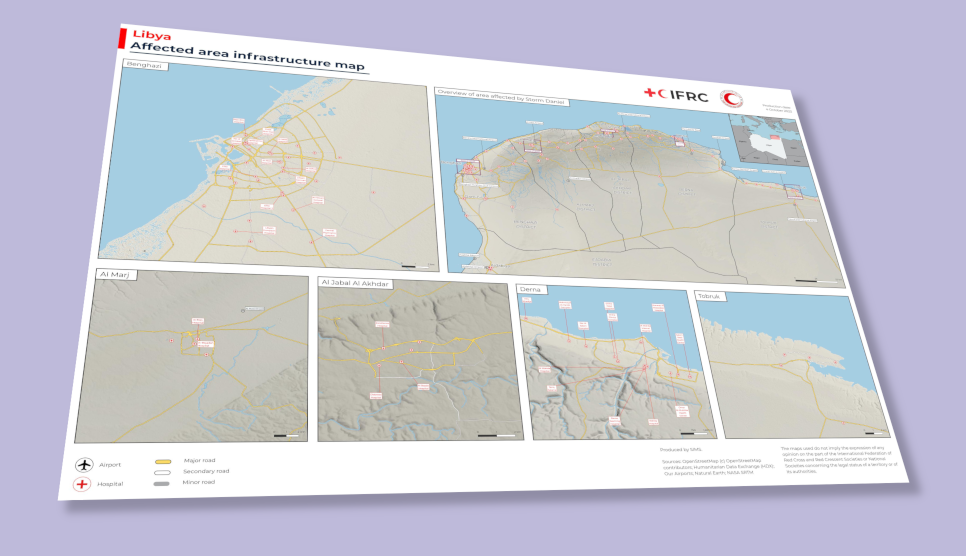
The map shows key infrastructure in the area affected by the storm: roads, airports, hospitals and rivers - mostly from OpenStreetMap / Humanitarian Data Exchange. I added terrain from NASA SRTM elevation data - I posted about that separately here.
The OSM hospitals data was supplemented by a list of hospitals from local partners which I ran through Google Translate to get the names in English. The OSM health site data is a bit messy so I chose to show all features tagged as healthcare:* but to only label those with "hospital" in the name.